Longest Rivers in the World
Rivers are flowing bodies of water which flow from higher to lower ground. Every river always starts at a source and ends at a so-called mouth. The mouth is usually located at another body of water such as an ocean, a sea, a lake or another river in which the river flows into. Sometimes rivers will, however, just flow into the ground and dry up there. Rivers have historically been extremely important for both nature and human civilization as rivers make life away from sea shores possible. Even today most cities which are not located at a sea or ocean, are usually built around or at a river. The 10 longest rivers in the world are all longer than 4,000 kilometers / 2,500 miles.
Note: For this ranking, rivers are being counted individually and not wholly as their river system. The Mississippi-Missouri river system in the United States for example is the fourth-longest river system in the world, but individually neither river of the system makes the Top 10 of longest rivers in the world.
The 10 Longest Rivers in the World
1. Nile
The Nile River in Egypt
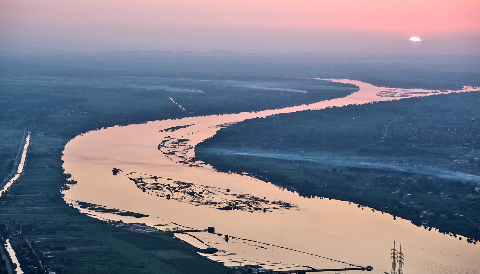
Length: 6,695 km / 4,160 mi
Source location: Multiple / Disputed
Mouth location: Nile Delta (between Beheira, Egypt & Kafr El Sheikh Governorate, Egypt)
Outflow into: Mediterranean Sea
Flowing through: Egypt, Sudan, South Sudan, Ethiopia, Uganda, Congo, Kenya, Tanzania, Rwanda & Burundi
The Nile is the longest river in the world. It has a total length of at least 6,695 km / 4,160 miles. It should be noted, however, that many consider the Nile to be even longer. The dispute stems from the fact that the source of the Nile is disputed. Some consider Lake Victoria, Africa’s largest and the world’s third-largest lake, to be the source of the Nile. But Lake Victoria itself has multiple feeder rivers which could be the original source of the Nile, making the world’s longest river even longer. The Nile is, in any case, of huge importance to Northeastern Africa. It is in the Nile basin where many ancient African civilizations evolved. The Nile still flows through some of the oldest cities in human history such as Egypt’s capital Cairo or Luxor, the ninth-oldest city still inhabited.
[epic_element_ads google_publisher_id=”ca-pub-9590806288512474″ google_slot_id=”6289510267″]
In total, the Nile flows through 10 countries (Burundi, Rwanda, Tanzania, Kenya, Congo, Uganda, Ethiopia, South Sudan, Sudan and finally Egypt), a record the Nile shares only with the Danube river in Europe. While the source of the Nile is disputed, its mouth in the Nile Delta in Northern Egypt, not far from the likewise ancient-old city of Alexandria, is well known. The Nile flows into the Mediterranean Sea.
2. Amazon River
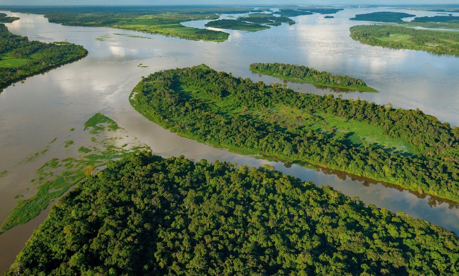
The Amazon river flowing through a typical Amazon forest landscape
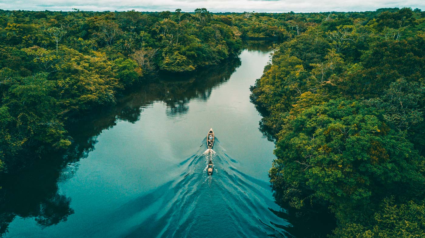
Length: 6,575 km / 4,086 miles
Source location: Montaro River, Department of Junin, Peru
Mouth location: Amapa State, Brazil
Outflow into: Atlantic Ocean
Flowing through: Brazil, Colombia, Peru
With a length of at least 6,575 km / 4,086 miles, the Amazon River in South America is the second-longest river in the world. While the source of the Amazon River is also a topic of controversy, it is now generally accepted as the Mantaro River in the Junin Department of Central Peru. While the Amazon River (likely) is “only” the second longest river on Earth, it is by far our planet’s largest. The Amazon River alone carries around 20% or 1/5 of the planet’s freshwater river flow. The Amazon River and its surrounding Amazon rainforest, is also a true treasure of biodiversity. In fact, it is the most biodiverse region in the world. An estimated 360 billion trees of around 16,000 known species can be found in the Amazon river basin.
The Amazon rover flows through Peru, Colombia and then mostly Brazil. Its mouth is located in Amapa State on Brazil’s Northeastern coast, where the river ultimately flows into the Atlantic Ocean.
3. Yangtze River
The Yangtze flowing through the Qutang Gorge

Length: 6,236 km / 3875 miles
Source location: Tanggula Mountains, Tibet, China
Mouth location: Between the Municipality of Shanghai, China & Province of Jiangsu, China
Outflow into: East China Sea
Flowing through: China
The Yangtze River is the third longest river on Earth. And it is without a doubt among the world’s most picturesque rivers. The Yangtze measures 6,236 km / 3875 miles, making it the longest river in all of Asia. The river originates in the Tanggula Mountains of Tibet and flows eastwards through many of China’s largest cities and many of China’s most spectacular natural landscapes such as the Three Gorges in the municipality of Chongqing in central China. The Yangtze’s mouth is located between Shanghai, the most populous city in the world, and the Chinese province of Jiangsu, where it flows into the East China Sea. In China the river is known as “Chang Jiang” which literally translates to “Long River”. Quite a fitting name indeed.
The Yangtze exclusively flows through China. It is therefore also the world’s longest single-country river.
4. Yellow River
The Yellow River flowing through the city of Lanzhou, China

Length: 5,778 km / 3,590 miles
Source location: Bayan Har Mountains, Qinghai, China
Mouth location: Dongying, Shandong, China
Outflow into: Yellow Sea
Flowing through: China
The fourth longest of the Top 10 longest rivers in the world is also entirely located within China. The Yellow River is 5,778 km / 3,590 miles long. Its source can be found in the Bayan Har Mountains in the Northwestern Chinese province of Qinghai. The Yellow River (Huang He in Chinese) got its name for its yellowish appearance. This is due to the unusual high amount of slit the river carries. The Yellow River has historically been an upmost important river for China since China’s entire ancient history was built around the Yellow River basin. The river, however, has also been known for the many devastating floods it caused throughout China’s long history. The Yellow River flows through many of China’s largest cities, most notably through Lanzhou. The river’s mouth is located in the city of Dongying, Shandong. Here, the river flows into the Yellow Sea, its namesake.
Like the Yangtze, the Yellow River, as already mentioned, flows exclusively through China.
[epic_element_ads google_publisher_id=”ca-pub-9590806288512474″ google_slot_id=”6289510267″]
5. Parana River
The Parana River, at the confluence with the Iguazu River at the Hito Tres Fronteras, which marks the border between Argentina, Brazil (left shore) and Paraguay (right shore),

Length: 4,880 km / 3,030 miles
Source location: Paranaiba River, Minas Gerais, Brazil
Mouth location: Rio de la Plata (between Buenos Aires Province, Argentina & Colonia Department, Uruguay)
Outflow into: Atlantic Ocean
Flowing through: Argentina, Brazil, Paraguay, Uruguay
The Top 5 of the Top 10 longest rivers in the world is completed by the Parana River. With a length of 4,880 km / 3,030 miles the South American river is considerably smaller than the Amazon, but nevertheless still plays a major role on the continent. Not only does it provide important economical value, but it is also politically relevant. Large portions of the river represent the borders between the countries of Argentina, Brazil and Paraguay. The river’s source is the Paranaiba River in the southeastern Brazilian state of Minas Gerais. The Parana River then flows through Paraguay and Argentina before reaching its mouth. Here the rivers forms a border between Argentina and Uruguay. The mouth is located between Argentina’s Buenos Aires province and Uruguay’s Colonia Department to be more precise. Here, the Parana River flows into the Atlantic Ocean.
The river therefore flows through 4 countries, one more than the Amazon river even.
6. Congo River
The Congo River flowing through the main Congo River Valley
Length: 4,374 km / 2,718 mi
Source location: Lualaba River, Boyoma Falls, Democratic Republic of the Congo
Mouth location: Between Kongo Central, Democratic Republic of the Congo & Zaire Province, Angola
Outflow into: Atlantic Ocean
Flowing through: Democratic Republic of the Congo, Congo, Angola
The Congo River, formerly known as the Zaire River during the dictatorship of Mobutu Sese Seko, is the second longest river in Africa, shorter only than the Nile, as well as the second largest river in the world by discharge volume, following only the Amazon. It is also the worlds deepest recorded river, with measured depths in excess of 220 m (720 ft).
7. Mekong River
The Mekong River flowing between the Nong Khai Province of Thailand & Vientiane Prefecture, Laos. The river forms the biggest part of the border between Thailand & Laos.

Length: 4,350 km / 2,703 mi
Source location: Mount Guozongmucha, Qinghai, China
Mouth location: Mekong Delta (between Tien Giang Province, Vietnam & Ben Tre Province, Vietnam)
Outflow into: South China Sea
Flowing through: China, Myanmar, Laos, Thailand, Cambodia, Vietnam
The Mekong, or Mekong River, is a trans boundary river in East Asia and Southeast Asia. It is one of the worlds longest river and the seventh longest in Asia. Its estimated length is 4,350 km (2,703 mi), and it drains an area of 795,000 km2 (307,000 sq mi), discharging 475 km3 (114 cu mi) of water annually. From the Tibetan Plateau the river runs through China, Myanmar, Laos, Thailand, Cambodia, and Vietnam. The extreme seasonal variations in flow and the presence of rapids and waterfalls in the Mekong make navigation difficult. Even so, the river is a major trade route between western China and Southeast Asia.
Mekong is originally called Mae Nam Khong from a contracted form of Tai shortened to Mae Khong. In Thai and Lao, Mae Nam “Mother of Water” is used for large rivers and Khong is the proper name referred to as “River Khong”. However, Khong is an archaic word meaning “river”, loaned from Austroasiatic languages, such as Vietnamese sông and Mon krun “river”, which led to Chinese whose Old Chinese pronunciation has been reconstructed as and which long served as the proper name of the Yangtze before becoming a generic word for major rivers. To the early European traders, the Mekong River was also known as Mekon River, May-Kiang River and Cambodia River.
8. Lena River
The Lena River near the Siberian city of Yakutsk, Russia.

Length: 4,294 km / 2,668 mi
Source location: Baikal Mountains, Irkutsk Oblast, Russia
Mouth location: Lena Delta, Yakutia, Russia
Outflow into: Laptev Sea
Flowing through: Russia
The Lena is the easternmost of the three great Siberian rivers that flow into the Arctic Ocean. It is 4,294 kilometres (2,668 mi) long, and has a drainage basin of 2,490,000 square kilometres (960,000 sq mi).
[epic_element_ads google_publisher_id=”ca-pub-9590806288512474″ google_slot_id=”6289510267″]
The area of the Lena river basin is calculated at 2,490,000 square kilometres (961,394 sq mi) and the mean annual discharge is 489 cubic kilometers per year. Gold is washed out of the sands of the Vitim and the Olyokma, and mammoth tusks have been dug out of the delta.
9. Irtysh River
The Irtysh River flowing through the city of Omsk, Russia
Length: 4,248 km / 2,640 mi
Source location: Altai Mountains, Bayan-Oelgii Province, Mongolia
Mouth location: Khanty-Mansi Autonomous Okrug, Russia
Outflow into: Ob River
Flowing through: Russia, Kazakhstan, China, Mongolia
From its origins as the Kara-Irtysh (Vast Irtysh, kara means Vast in Turkic languages but also black. But in the context and geographic terms usually refers vast) in the Mongolian Altay mountains in Xinjiang, China, the Irtysh flows northwest through Lake Zaysan in Kazakhstan, meeting the Ishim and Tobol rivers before merging with the Ob near Khanty-Mansiysk in western Siberia, Russia after 4,248 kilometres (2,640 mi).
The name Black Irtysh (Kara-Irtysh in Kazakh, or Cherny Irtysh in Russian) is applied by some authors, especially in Russia and Kazakhstan, to the upper course of the river, from its source entering Lake Zaysan. The term White Irtysh, in opposition to the Black Irtysh, was occasionally used in the past to refer to the Irtysh below lake Zaysan; now this usage is largely obsolete.
10. Niger River
The Niger River near Niamey, Niger
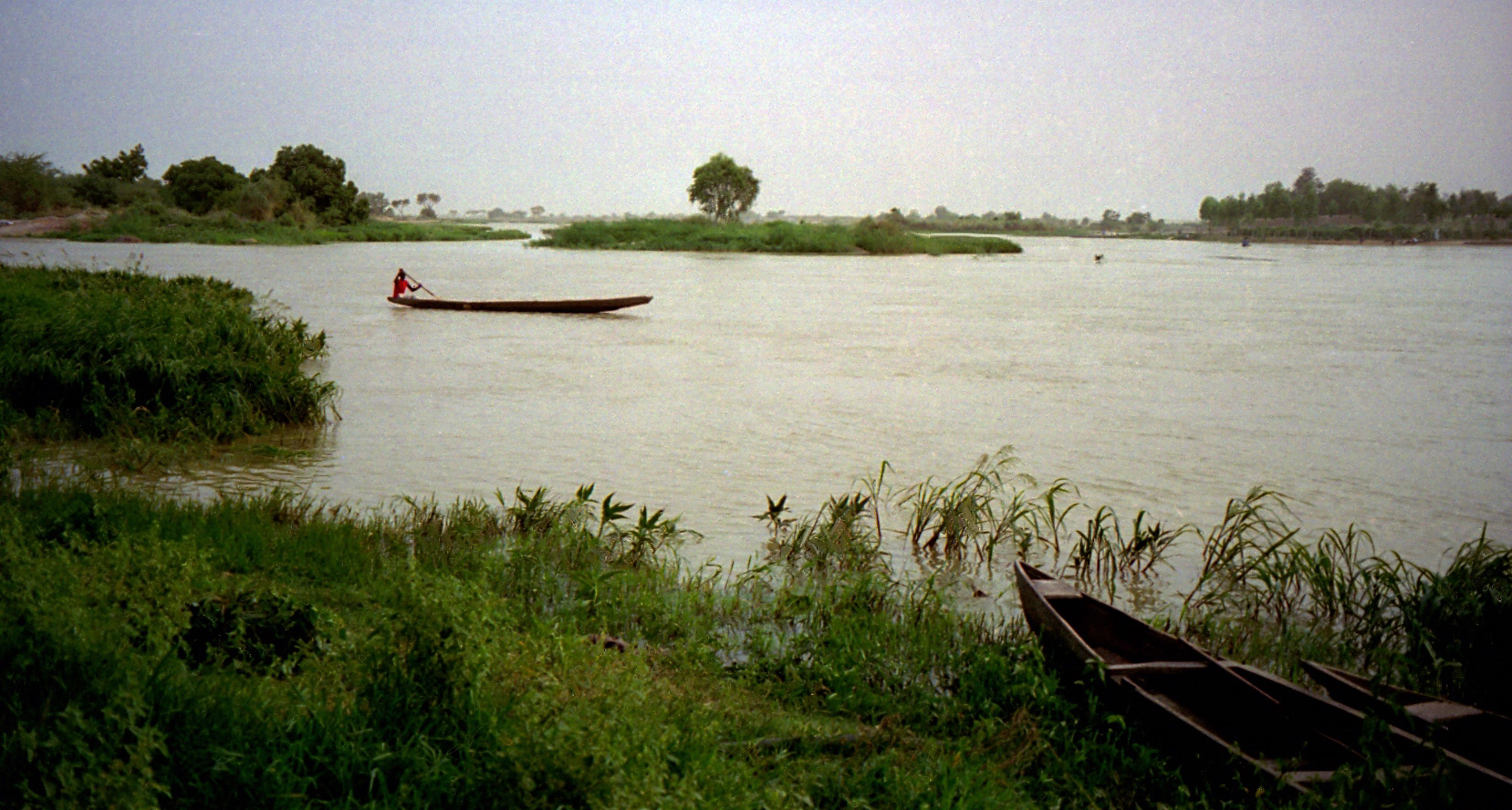
Length: 4,180 km / 2,597 mi
Source location: Guinea Highlands, Faranah Region, Guinea
Mouth location: Niger Delta, Bayelsa, Nigeria
Outflow into: Atlantic Ocean
Flowing through: Guinea, Mali, Niger, Benin, Nigeria
The Niger River is a relatively clear river, carrying only a tenth as much sediment as the Nile because the Nigers headwaters lie in ancient rocks that provide little silt. Like the Nile, the Niger floods yearly; this begins in September, peaks in November, and finishes by May.
An unusual feature of the river is the Inner Niger Delta, which forms where its gradient suddenly decreases. The result is a region of braided streams, marshes, and lakes the size of Belgium; the seasonal floods make the Delta extremely productive for both fishing and agriculture.
